Sign in, say "hi", ... and be welcomed.

Re: Flight Log (all flying-related activities welcome)

Postby Bob Kuczewski » Tue May 15, 2012 10:59 pm

Great story Bill!!!      :shock:

I've heard of it raining cats and dogs, but free falling sky divers add a whole new dimension. Thanks for sharing that hang gliding story.    :thumbup: :thumbup: :thumbup:

By the way, I flew Torrey Pines again today. I was mostly there to help a friend with her kiting (see the story posted about Robin calling the police), but I did get in a short hang glider flight. Here are the photos:

Hook In Check ... just before launch:
vf00.jpg
vf00.jpg (80.66 KiB) Viewed 5179 times


Launch Run:
vf01.jpg
vf01.jpg (49.93 KiB) Viewed 5179 times


Immediately after going to base tube, but before kicking into harness:
vf02.jpg
vf02.jpg (48.23 KiB) Viewed 5179 times


Low on the north face ridge heading north after launch:
vf03.jpg
vf03.jpg (59.17 KiB) Viewed 5179 times


Turning back south:
vf04.jpg
vf04.jpg (38.61 KiB) Viewed 5179 times


Heading north again with more altitude:
vf05.jpg
vf05.jpg (49.92 KiB) Viewed 5179 times


Heading south over Black's Beach:
vf06.jpg
vf06.jpg (39.37 KiB) Viewed 5179 times


Approaching the gliderport from the south with a friend kiting in the LZ:
vf07.jpg
vf07.jpg (52.12 KiB) Viewed 5179 times


Turning south with the golf course and flat rock in the distance:
vf08.jpg
vf08.jpg (28.92 KiB) Viewed 5179 times


Downwind approach with a fair amount of speed:
vf09.jpg
vf09.jpg (48.76 KiB) Viewed 5179 times


Final approach ... ready to run it out:
vf10.jpg
vf10.jpg (49.19 KiB) Viewed 5179 times


Running it out:
vf11.jpg
vf11.jpg (44.7 KiB) Viewed 5179 times


Carrying back to the tie-down area:
vf12.jpg
vf12.jpg (43.83 KiB) Viewed 5179 times
Join a National Hang Gliding Organization: US Hawks at ushawks.org
View my rating at: US Hang Gliding Rating System
Every human at every point in history has an opportunity to choose courage over cowardice. Look around and you will find that opportunity in your own time.
Bob Kuczewski
User avatar
Contributor
Contributor
 
Posts: 8515
Joined: Fri Aug 13, 2010 2:40 pm
Location: San Diego, CA

Re: Flight Log (all flying-related activities welcome)

Postby Bob Kuczewski » Thu Aug 30, 2012 1:28 am

August 29th, 2012

I had a short flight at Funston today. I drove all the way from San Diego in 100 degree heat and got to Funston in time to assemble my Falcon, get a 12 minute flight, and disassemble it ... all before the park closed at Sunset. One of the other pilots said I was the only person to actually fly. Fortunately, the traffic in L.A. was tolerable or there wouldn't have been any flights at Funston today.
Join a National Hang Gliding Organization: US Hawks at ushawks.org
View my rating at: US Hang Gliding Rating System
Every human at every point in history has an opportunity to choose courage over cowardice. Look around and you will find that opportunity in your own time.
Bob Kuczewski
User avatar
Contributor
Contributor
 
Posts: 8515
Joined: Fri Aug 13, 2010 2:40 pm
Location: San Diego, CA

Re: Flight Log (all flying-related activities welcome)

Postby Bob Kuczewski » Thu Aug 30, 2012 11:35 pm

I had two great flights at Funston today. The first was 1 hour (from 1pm to 2pm). The second flight was 1 hour 20 minutes (from 3pm to 4:20pm). Here are some photos:

2012_08_30_ss1.jpeg
2012_08_30_ss1.jpeg (71.48 KiB) Viewed 5133 times


2012_08_30_ss2.jpeg
2012_08_30_ss2.jpeg (58.27 KiB) Viewed 5133 times


2012_08_30_ss3.jpeg
2012_08_30_ss3.jpeg (47.35 KiB) Viewed 5133 times


2012_08_30_ss4.jpeg
2012_08_30_ss4.jpeg (55.24 KiB) Viewed 5133 times


2012_08_30_ss5.jpeg
2012_08_30_ss5.jpeg (57.93 KiB) Viewed 5133 times
Join a National Hang Gliding Organization: US Hawks at ushawks.org
View my rating at: US Hang Gliding Rating System
Every human at every point in history has an opportunity to choose courage over cowardice. Look around and you will find that opportunity in your own time.
Bob Kuczewski
User avatar
Contributor
Contributor
 
Posts: 8515
Joined: Fri Aug 13, 2010 2:40 pm
Location: San Diego, CA

Flight from Hammondsport, NY 9/10/12

Postby wingspan33 » Thu Sep 20, 2012 9:59 am

The following description is of my Sept. 10th flight from a local site. The launch is called Hammondsport, but it's not actually in Hammondsport. Launch is actually in the Town of Bath, NY up on Mt Washington, on a local farmer's property (thanks Rick!). It has gained the shortened name of H-Port. For informational purposes, Hammondsport, NY is where Glen Curtiss, pioneer aviator, began his efforts to get into the sky. For those with Google Earth (or similar program) if you want to see the area I was flying over, the launch co-ords are N 42 deg. 22.487 W 77 deg. 15.664.

Anyway, the flight report, . . .

The wind was puffing a bit today but it didn't look too bad. So, I headed up to the H-Port launch. Now this was around 4:30 pm, with the idea that the later afternoon winds would be a little less intense. Ends up predictions were low at around 12 mph at launch alts. Reality was that winds were, in places, gusting to over 20.

Upon arriving at launch it was otherwise deserted. I could see the trees moving but it didn't look overly strong. It actually looked pretty nice. I carted the glider up to the upper launch and began to set up.

I was ready to launch at 5:30 and entered the sky at 5:37 pm. Like last launch I entered the air horizontally AND vertically. 230 foot gain in the first minute. Oh Boy!

The lift seemed to consist of mostly ridge lift with some thermal buoyancy here and there. I think the wind was just about STFI along the ridge. I made about 3 trips down the ridge toward Bath and back to launch. The best stuff seemed to be a little ways south of the church. With the N - NNW wind direction, perhaps this actually was the hospital/church generated thermal. Thing is, however, the remaining thermals were poorly defined. They may have been much better at 1-2 pm, but they were mixing with the generally higher winds and being subdued somewhat.

With the wind speed hitting the high teens to twenty on the ridge top, I decided not to try a top landing in my new(er) top LZ. I figured the valley winds would be slower and less "textured", if you know what I mean.

However, the church LZ has not been maintained and I see it as dangerous for hang gliders. The only available landing spots (limited because of the corn) have weeds that are 4 ft high. The lane that comes up along the church property would be a great spot to glide in, but it too has weeds along the sides that are high enough to (very likely) prevent a good, proper flair. Broken arms are not fun. I'm happy that the PG crowd can still land safely there.

My chosen spot to touch down was a field near the border of the village of Bath - along Rt 54. I had another spot as a back up, but this field worked out okay. It works out to be around 2.5 miles south of launch.

So, like last flight, I didn't want to get stuck with no choice but the church LZ. With that in mind, I chose to extend my last southerly ridge run to past the end of the ridge and out over this field.

In the end I got 34 minutes of air time (landing at 6:11 pm), which is nothing to brag about, but it's more air time than anyone else got at H-Port today.

Oddly, the last couple days I've flown (since my bad landing) have had limited thermal lift and choppy or higher speed air (today's air was mostly very smooth but moving along pretty good). On either flight there hasn't been a nice comfort factor with the church LZ being pretty much useless to hang gliders. That has caused me to be cautious about being able to land in a GOOD place.

It's best to land where you want, when you can, then to land where you don't want - when you have no choice. Maybe next flight I'll get an hour or more.

Stats for this flight -

Max alt = 2,435 MSL = 2,250 over the valley and 675 over launch.

Average alt = around 1,150 over the valley or 400 ft over launch.

The air was relatively smooth with mainly basic ridge lift and limited, very mild thermal activity.

Now I'm waiting for the next good day.
wingspan33
User avatar
Contributor
Contributor
 
Posts: 1150
Joined: Fri Aug 13, 2010 8:24 pm

Re: Flight Log (all flying-related activities welcome)

Postby Bob Kuczewski » Thu Sep 20, 2012 10:31 am

Great description of the flight and the area!!

Are the launch and landing areas you described contained in this map?

HPort_Bath_Hammondsport_NY.jpeg
HPort_Bath_Hammondsport_NY.jpeg (55.7 KiB) Viewed 5094 times
Join a National Hang Gliding Organization: US Hawks at ushawks.org
View my rating at: US Hang Gliding Rating System
Every human at every point in history has an opportunity to choose courage over cowardice. Look around and you will find that opportunity in your own time.
Bob Kuczewski
User avatar
Contributor
Contributor
 
Posts: 8515
Joined: Fri Aug 13, 2010 2:40 pm
Location: San Diego, CA

H-Port Flight

Postby wingspan33 » Thu Sep 20, 2012 11:30 am

Yes, Bob, the launch is included in the map you've posted. If you look for the "Co Rd 113" label that is up on the hill, go straight up (north) from the "113" and you will see a "knob" on the ridge. There are two launches along the NNW face of the ridge in that section.

My landing location was just south of the "Co" in the valley label for "Co Rd 113". It's not easy to describe where the usual valley (HG unfriendly tall weed and corn filled) LZ is located.

Our Mossy Bank flying site is also on that map. It's just south of the "17" label along the Southern Tier Expressway. My not so good landing was where the "15" label sits along the same route.

Even where I live is on that map. Just a bit east of the "Geneva St" label.

Heck, you've got my whole local world right there in that graphic! lol :thumbup:
wingspan33
User avatar
Contributor
Contributor
 
Posts: 1150
Joined: Fri Aug 13, 2010 8:24 pm

Flight from the log book.

Postby Bill Cummings » Tue Nov 06, 2012 5:04 pm

Lesson learned

(The hard way.)
By Bill Cummings

Tossed like a leaf in a tornado I was totally freaked out and wishing I had never headed my 155’ Magic III hang glider into the giant dust devil. Today, Wednesday July 10, 1991 was the peak of the day in the peak of the strong thermal season over the tilled wheat fields of central Washington State. It was my wife Terry’s day to drive and she had Gene Stone (A friend from Pharr, TX.) at the top of the 2,000’ static tow line and he was just about to release from the line. I wanted to radio Gene to tell him not to follow me into the dust devil but the transmit switch was mounted on my helmet and I couldn’t make my self let go of the control bar. I had stupidly broken my own rule to never fly into one of these giant dust devils. The big devils that leave a circle print on the ground measuring a half mile in diameter. The smaller “dusties,” that come to a point on the ground are a size that usually won’t peg my coward meter like this one did. I pulled myself half way through the control frame so as not to stall in the turbulence. The extra speed made the turbulence feel twice as rough but still it was stalling from time to time. This speed seemed the middle ground between stalling and tumbling or being beat to death with the keel tube when going weightless. I checked to make sure my tow bridle would not be in the way if I had to reach for my parachute handle. The handle was in the clear but amazingly the thought of the parachute being ready to be thrown offered very little comfort.
“I WANT TO LAND NOW!”
I flew out of the side of the thermal and way below I could see the only good shade tree near the town of Waterville, WA where I could knock down the glider in comfort out of the suns relentless stare. In my haste to land I totally forgot what hang gliding pilot Buck McMinn had taught me about landing during the heat of the day out here. Buck told me, “Pick out a good spot to land and hang out above it and slightly up wind. Wait for a thermal to go through your landing spot then leave it and auger down fast and land before another thermal can build and go through again.”
Just as I went vertical to go to the down tubes for landing a thermal broke loose and I had to go prone again to gain control! The glider was spun to the right and now I’m leading the way across the ground with my left wing tip! (About right here is where I remember what Buck had told me about landing during the heat of the day.) Here comes the ground! I’m still prone! It’s time to flare! I push out the base tube! I’m still moving sideways! I face plant! I blast out through the left downtube! The right downtube kinks in sideways at midpoint! The keel tube snaps in two just ahead of the control frame! The dust devil is now trying to lift me off of the ground! I hang onto what is left of the keel as close to the nose as I can reach while still hooked in! The glider starts to lift me off of the ground! I start screaming like preteen girl! The thermal drops me into another face plant! I do the fastest unhook I’ve ever done!
I was so glad to be down that I didn’t even get mad about having kinked so much aluminum. It was the longest 30 minute flight I can think of. Gene Stone flew 17 miles in good air. I had flown five miles. More than enough distance for me on this day. The glider was too broken up so I couldn’t move it into the shade to knock it down. I didn’t care. I was down. I was down! Lord I was DOWN!
Bill Cummings
User avatar
Contributor
Contributor
 
Posts: 3360
Joined: Wed Jul 13, 2011 6:20 pm
Location: Las Cruces NM 88005 (Region 4)

Re: Flight from the log book.

Postby Bill Cummings » Fri Nov 30, 2012 2:36 pm

Bob Move this story to flight log okay?
I was going to put it there to start with but I didn't scroll down far enough to find Flight Log when I posted.


Moderator's note: These posts were moved here from another topic per Bill's request.      ....      December 11th, 2012
Bill Cummings
User avatar
Contributor
Contributor
 
Posts: 3360
Joined: Wed Jul 13, 2011 6:20 pm
Location: Las Cruces NM 88005 (Region 4)

Re: Flight Log (all flying-related activities welcome)

Postby Bill Cummings » Sun Dec 02, 2012 6:15 pm

Pilots and Drivers,
The following is from my log book:
September 19, 2010 Sunday.
Wind SE 7-10 mph
Glider: Wills Wing, Sport II, 155 sq’, 2004
Glider airtime 87:46:30.

Only I towed up today at LRU (Las Cruces International Airport) but in attendance was Dave Church (tow driver), Allen Fisher, Robin and daughter, and I forgot the name of the friend along with them.

I saw for the first time the nose over rack that Dave had installed on his launch trailer. Dave says he next will move the nose release up from the trailer bed to the nose over rack. This will allow shorter nose release cords and a redundant safety tie down cord.

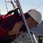
Dave towed me up three times. The 1st tow had me up to around 1,000’ agl (5,450’ msl). I went back to mid field and found the one thermal that I towed through low and started to circle up. (30 minute flight).

2.5 miles to the NW of midfield and only climbing at 200’/min I left the thermal at around 7,000’ msl and returned to the run up area on the start of runway 12. (120 degrees, magnetic) or towing to the SE.

The 2nd tow was totally in between thermal cycles and the flight was a sled ride back to the run up area of #12. (10 minute flight.)

The 3rd tow had me lower than the other two releases but because we were only ¾ of the way down the runway, when I was towed into a thermal, I radioed Dave to stop the truck for me to release the towline. After 42 turns I was three miles NW of midfield, 7,000’ msl, when Robin advised me that Dave was tired of towing me up so I’d better hang on to this one.

Off I go.

Ahead of me, down wind, was Blue Mesa at 19.8 miles from LRU. I decided to try an out and back so as not to make retrieve ridiculously long into the night. Plus Dave was chasing me with my car so me being as frugal as I am decided to stay on our side of the mountain and keep the gas consumption to a minimum.

The saving the gas plan worked but coming back against the wind proved to be just too much with the strength of the SE wind. I was only able to struggle back 3.8 miles giving me a total of 22.7 miles on my planned out and back of 39.6 miles. Adding to the weak lift was the fact that It was after 5 pm before I arrived at the Blue Mesa turn point. Maximum sink dashing between clouds was 1,280’/min. (Too much high pressure sinking air.) The average lift was usually around 200’/min. At altitude when I left a thermal at 10,007’ msl I checked my GPS as I stuffed the base tube for the next cloud and saw that my speed over ground was 58.7 mph. (Good tailwind between 8 and 10K’ msl.)

While I was thermaling I could hear Hadley Robinson chasing Lee Boon west down HWY #9. My squelch was set too high to hear Lee but I could hear Hadley on his powerful mobile unit.

This reminds me… I think we will move to 151.955 frequency up here at LRU so as not to interfere with the tow operation down near El Paso. For the tow up we use the USHPA assigned business band frequencies and only use the aircraft radio for announcing our use of the airport runways and taxiways.

My third flight was for an hour and fifty seven minutes. The three flights totaled 2hr and 37 minutes. :D
Bill Cummings
User avatar
Contributor
Contributor
 
Posts: 3360
Joined: Wed Jul 13, 2011 6:20 pm
Location: Las Cruces NM 88005 (Region 4)

Tree Landing 1980's

Postby Bill Cummings » Fri Mar 08, 2013 10:54 am

The quote below from Sam on the safe splat thread reminded me of a tree landing I had years back. Since I’m making a large step away from Joe’s Safe Splat topic I figured to move this report to a thread closer to the same topic.

Sam (the man)---
“After falling >300' wrapped up in the crumpled glider, the landing was a no stepper.”
Sam had said a pecan tree was between him and his impact zone. Which sounds like a well placed tree to me.

Here is my tree landing story:
Thirty miles to the west of where I lived in Minnesota was an old abandoned ski ridge that had been called Lookout Mountain. It was located north of Virginia, Minnesota on the Laurention Divide. This continental water shed divide decides which way the water flows. Either north into Canada or south into Lake Superior or down the Mississippi River to the Gulf of Mexico.

My pilot friend Don Ray of Aurora, MN and I set our Moyes Midi 220 sq’ glider on the control frame but left the wings folded. It was our water tow glider so we left the tail float and two base tube floats on and strapped three kid size plastic sleds, one to each float.
We next hooked a length of rope to the center base tube, stainless steel release and started pulling it over the snow to Lookout Mountain ski slope.

The road in hadn’t seen a snow plow in many years. We had a 8 mm camera mounted on the keel and we were able to see that Don keel assisted me but the base tube got too far ahead of me and I missed it with my left hand when going prone. This resulted in a diving right hand turn out over the tree line to the east. (My first and last keel assist.)
Just ahead were the high tension power lines that ran south to Virginia, MN.
Without enough room to turn left away from the hill I did a full flare to stop short of the power lines.

I was quite pleased to see that I was not going to be instantly cooked to a state of well done to overly done.

I now found myself in a true Indiana Jones situation. By that I mean just barely escaping one death threat to face the grim reaper’s next qualifying task into the after life.

My full flare had me stopped about 40’ over the 35 to 45 feet sleeping Birch and Aspen forest.

Realizing that this flight was going to be shorter than “The Lords Prayer” I let out a scream in case he wasn’t paying attention.

Both the glider and I dove nose first into the tops of the trees. The left tip caught and snapped and put the right tip leading the way down until it caught and snapped. Now it was nose first again and the branches really worked to slow the descent. When the glider came to a stop my feet hit the ground with the same force you would expect jumping down from a kitchen chair. The glider never touched the ground.

I was not experiencing any pain at all. I thought it must be that I broke my neck. I wiggled every thing that wiggles and finally came to the conclusion that I didn’t even have a scratch.
I was thinking that this tree landing business wasn’t as big of a deal that I had always thought it would be.

That thought didn’t last any longer than it took me to turn around to see what was 15 feet away.
A big tree had uprooted and fallen over leaving dried pointed root spires pointing straight up and fanning out like a peacock bird in display.
If I had landed 15 feet to the north I would have been a wooden, skewered, 180 pound, Shish Kabob!
Bill Cummings
User avatar
Contributor
Contributor
 
Posts: 3360
Joined: Wed Jul 13, 2011 6:20 pm
Location: Las Cruces NM 88005 (Region 4)

PreviousNext
Forum Statistics

Who is online

Users browsing this forum: No registered users and 258 guests

Options

Return to Hang Gliding General