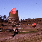
In Windsports agreements with ATC (or embedded in the County site contract ?) is a constraint on the top altitude of flight to be ever not more than 60 ft.
I once questioned that as for meaning of ASL or AGL, etc. No answer. But the actual takeoff altitude above LZ sand level is around 25 ft; a bit more for ASL. I started a topic in our forum about the matter. The literature has the slope height at various numbers. A careful survey could be a fun thing to do. Geological or construction survey notes might also be on record in the government offices. But fairly easy trigonometric surveying actions could bring us good numbers; a level and some measured sticks with a calculator would do the job. Our flying is within 5 miles of LAX, so there are kiting FARs; but there is also the "shielding" of the near Hyperion exhaust towers that give some allowance for altitude flying. Greblo once was himself kited on the beach to a fair altitude during a ceremony opening the Hang Gliding Flight Park; I do not know what altitude ASL he reached in his manned kiting. [ ??? ]
My survey was by eye-ball leveling multiple steps of approx. 5 ft. 6 in incremental steps: Look level; identify a stone or weed on the slope; walk to that point; repeat looking level using help of horizon; identify another object on the slope; repeat ... until done; start out far in the LZ sand. When the steps are exhausted, then count the steps; multiply the increments of 5 ft 6 in and presto: a figure is obtained. This can be improved upon.

Article in Los Angeles Times in 1989: " a manageable 17-foot-high bluff for takeoffs and an abundance of soft sand to cushion landings." In the same article: "Under the second phase, county planners are to draft, in the next six months, a blueprint for the beach and parking lot," THAT blueprint in file might note the ASL of the parking lot; the HG launch pads are nearly at the same altitude ASL as the new bike path and parking lot asphalt level.
Found something:

- Topo for the site.
- Screen Shot 2015-11-18 at 12.02.52 PM.png (53.84 KiB) Viewed 7958 times
So, do the subtractions: 35-15=20 So, if one lands at the 15 ft ASL mark, then the launch pad to that point has a drop of 20 ft. The LZ has a slow sloping to the water. Fly far to a 10 ft ASL point in the LZ and thus experience a launch of 35-10=25 for a 25 ft. drop. Get to the water and know a 35 ft drop and the ire of Greg.

And clip from document:

- Screen Shot 2015-11-18 at 12.40.48 PM.png (60.29 KiB) Viewed 7958 times


 .